Map Porn
Mississippi Meander Maps
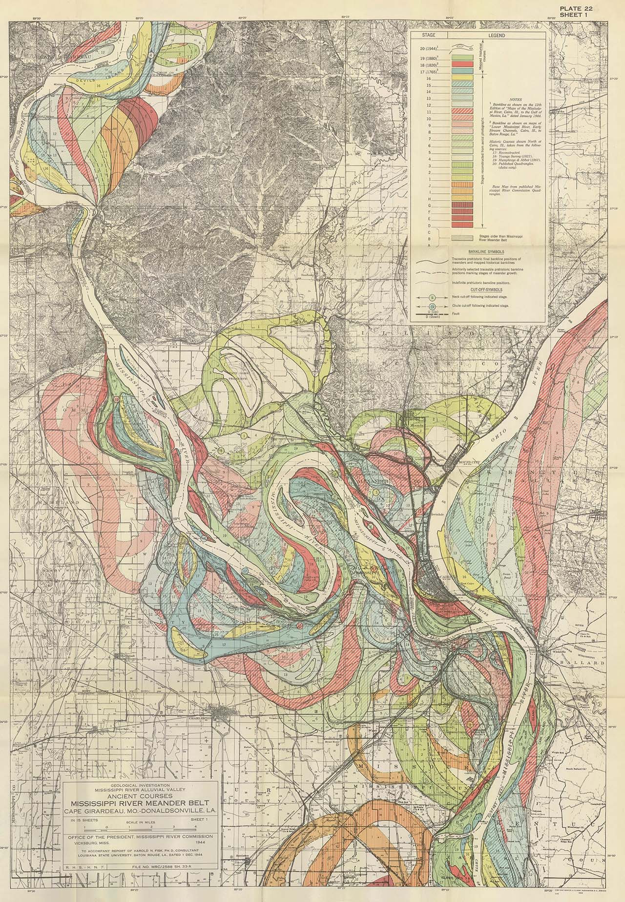
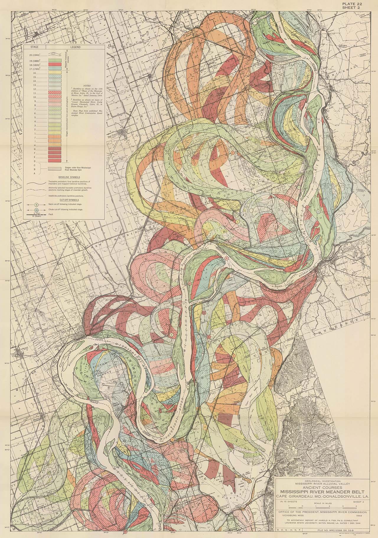
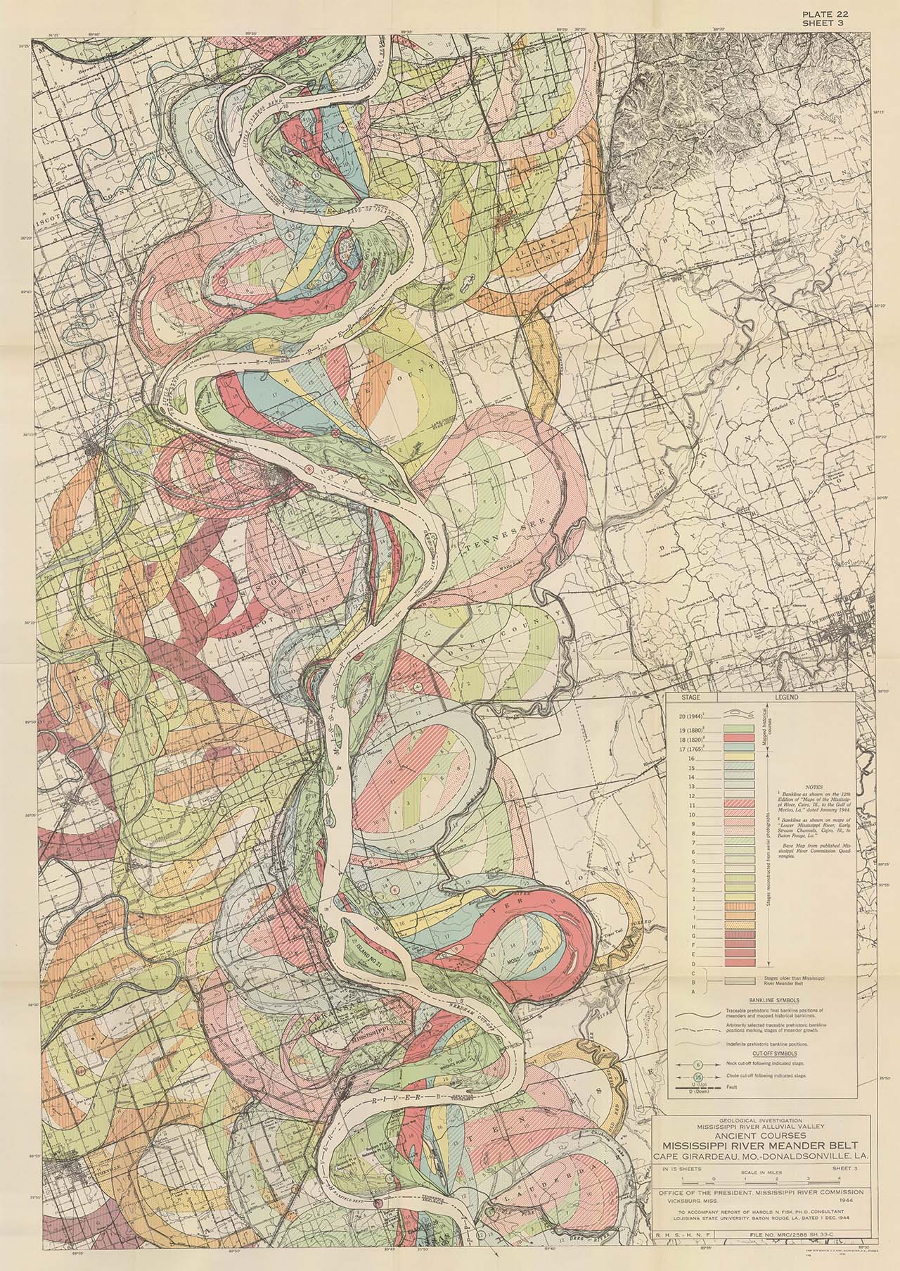
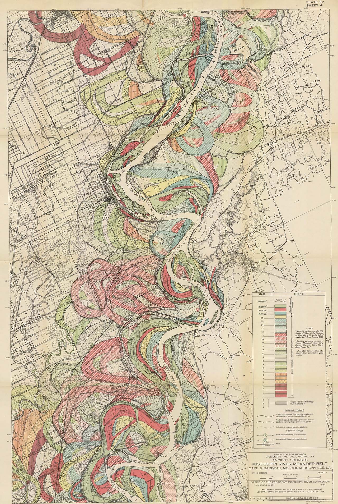
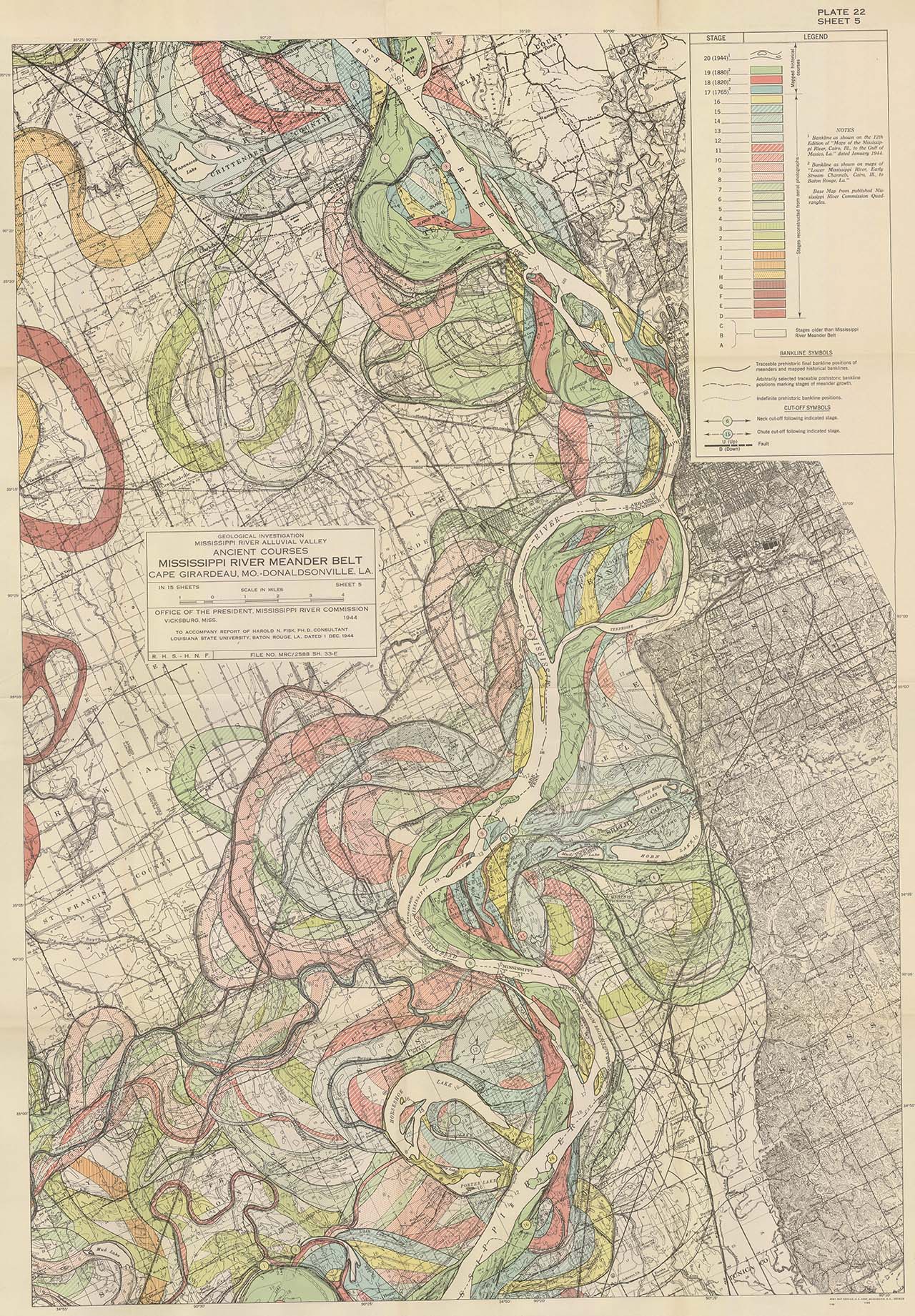
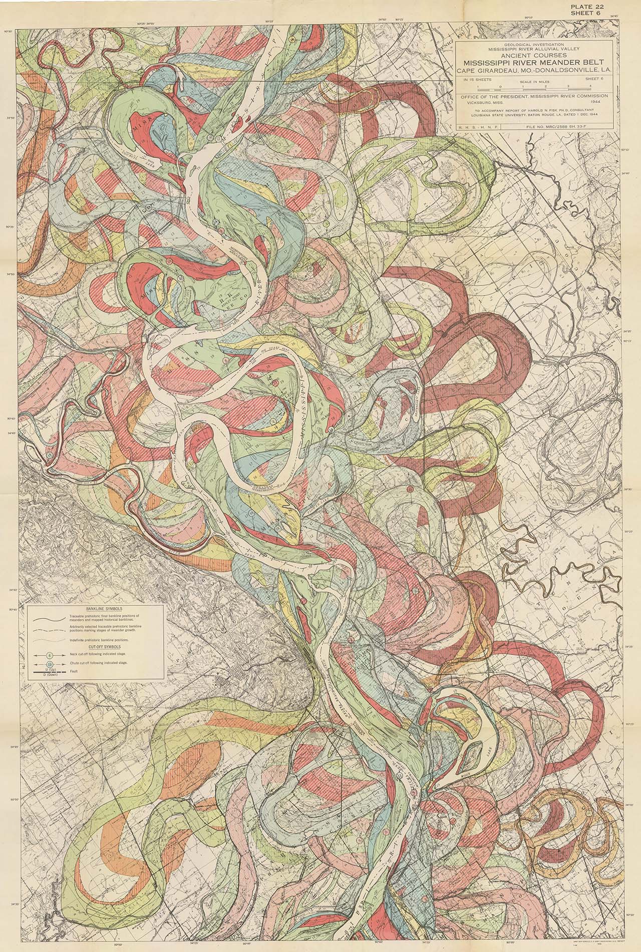
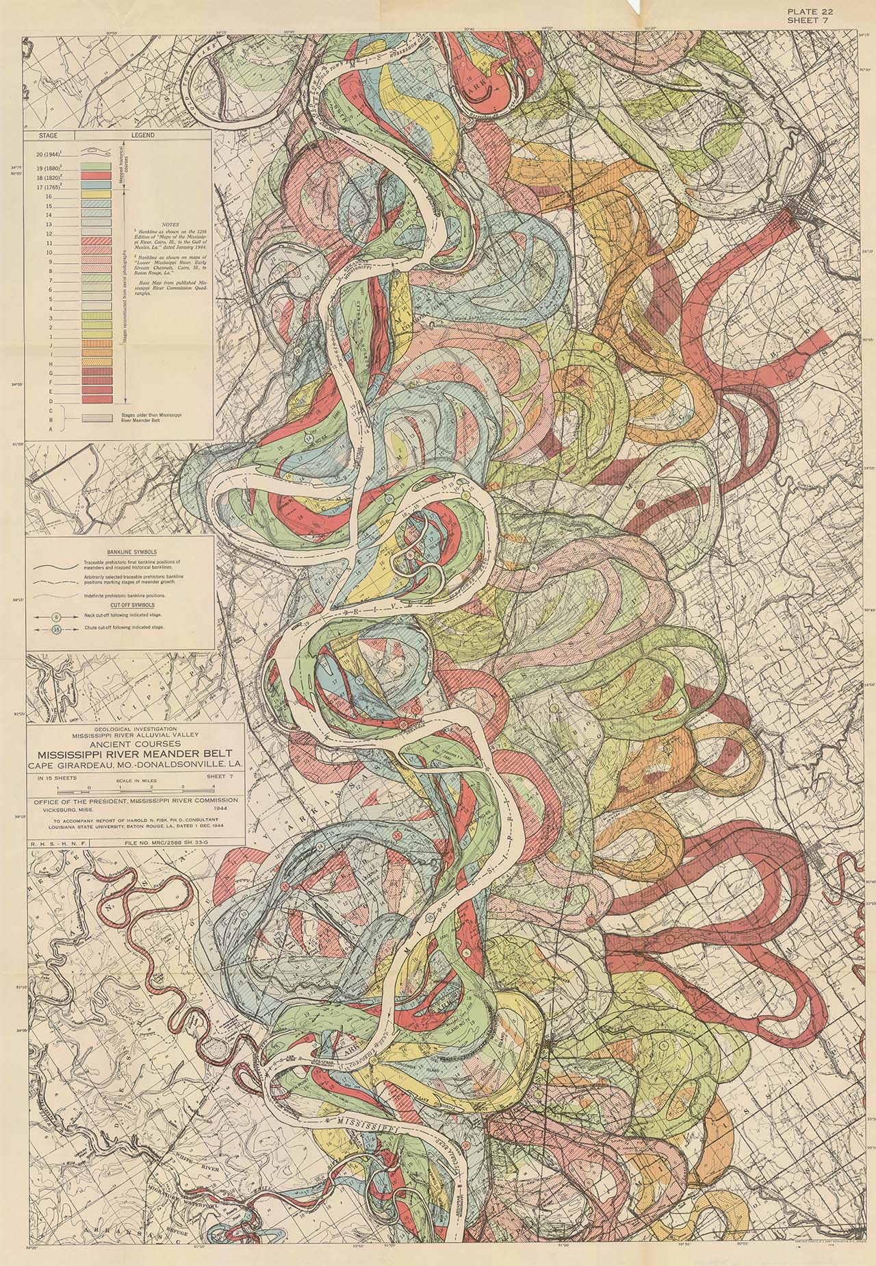
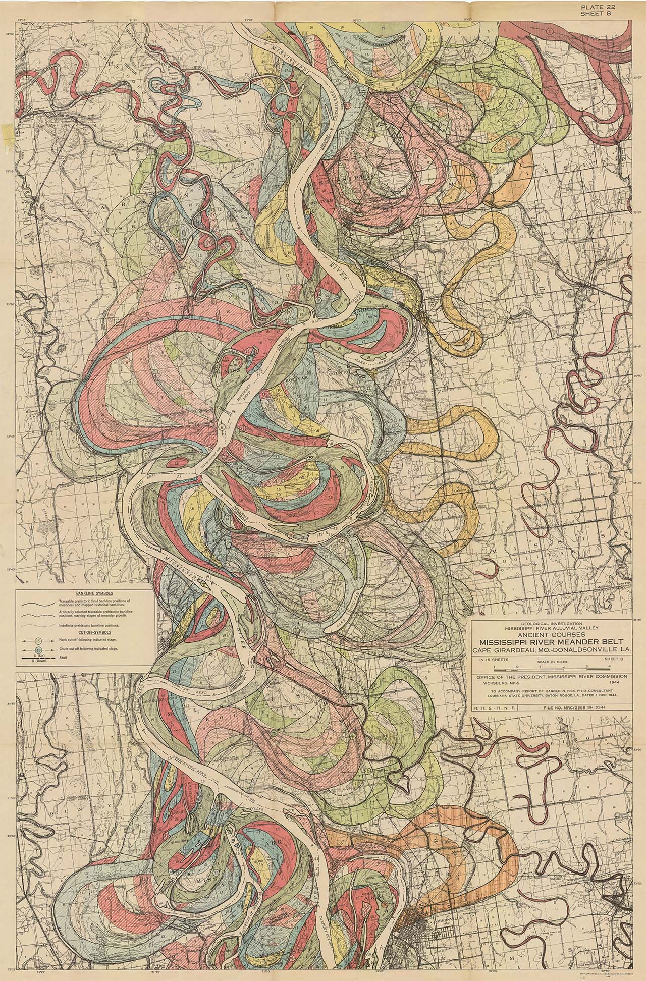
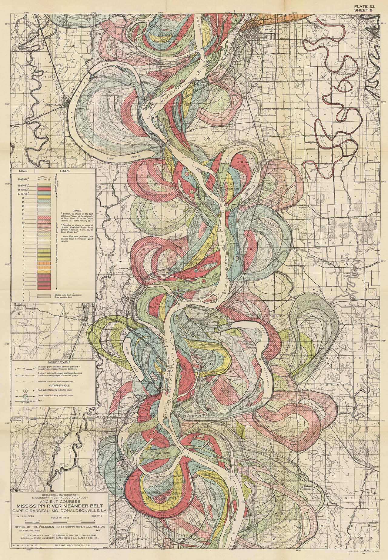
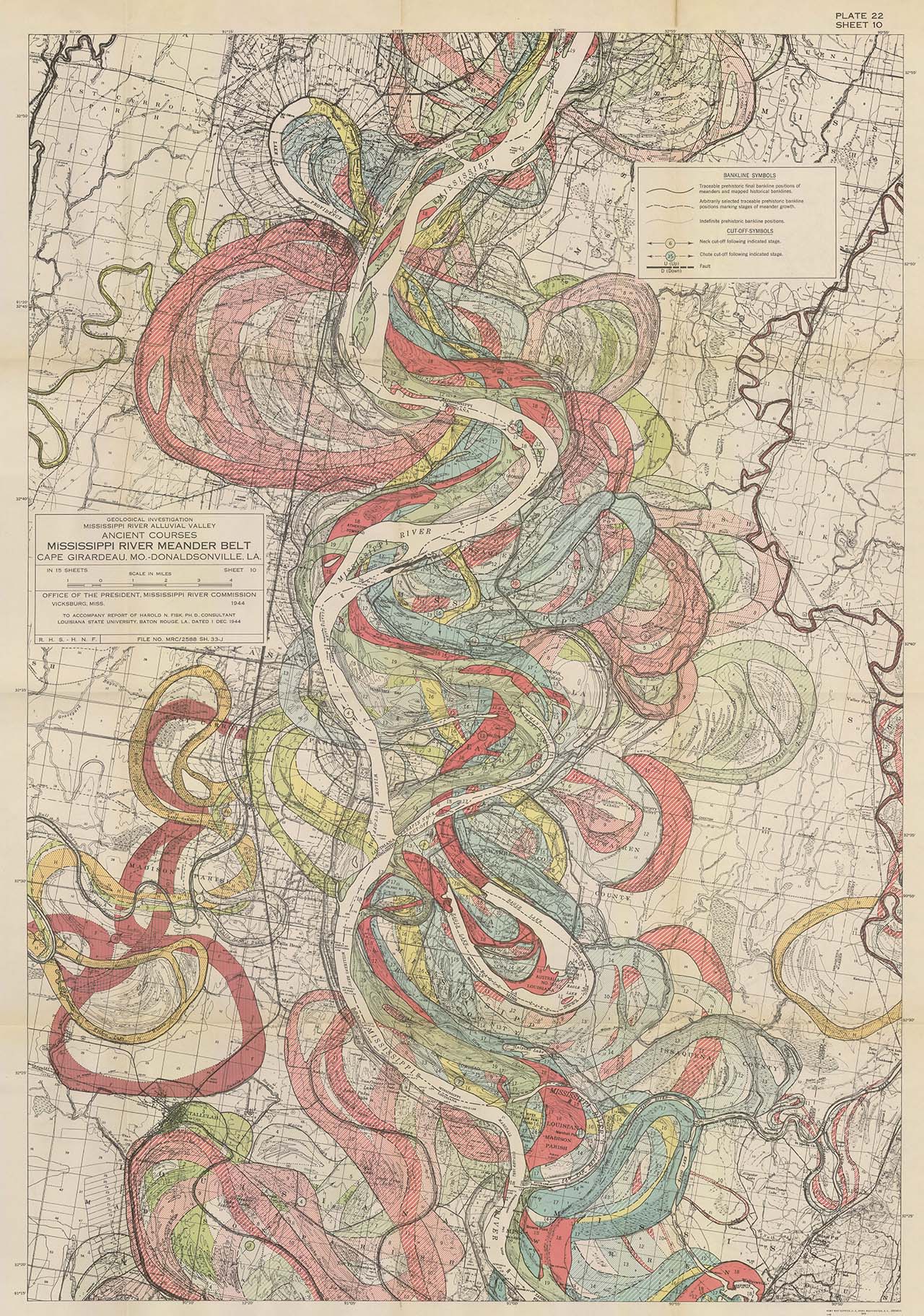
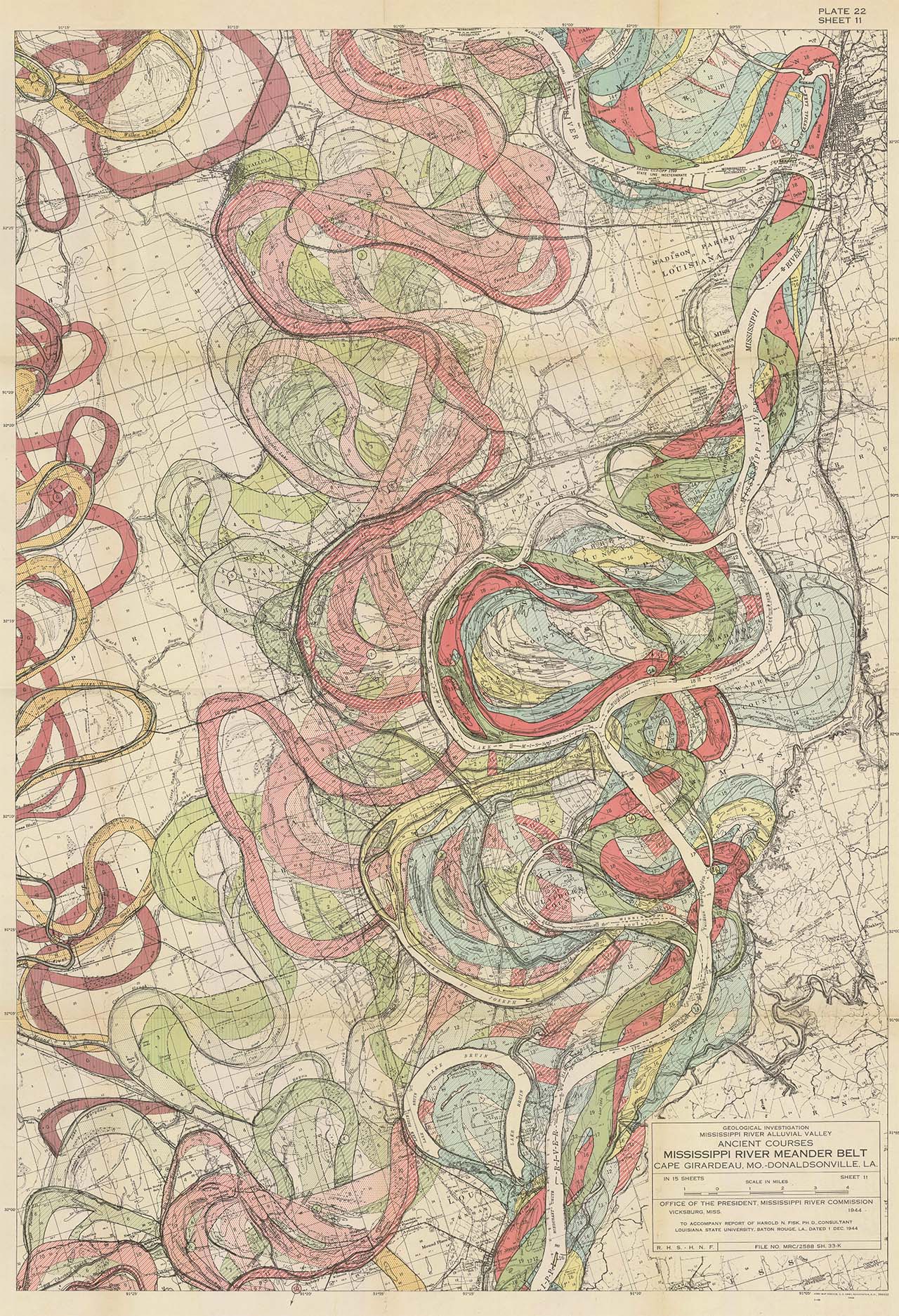
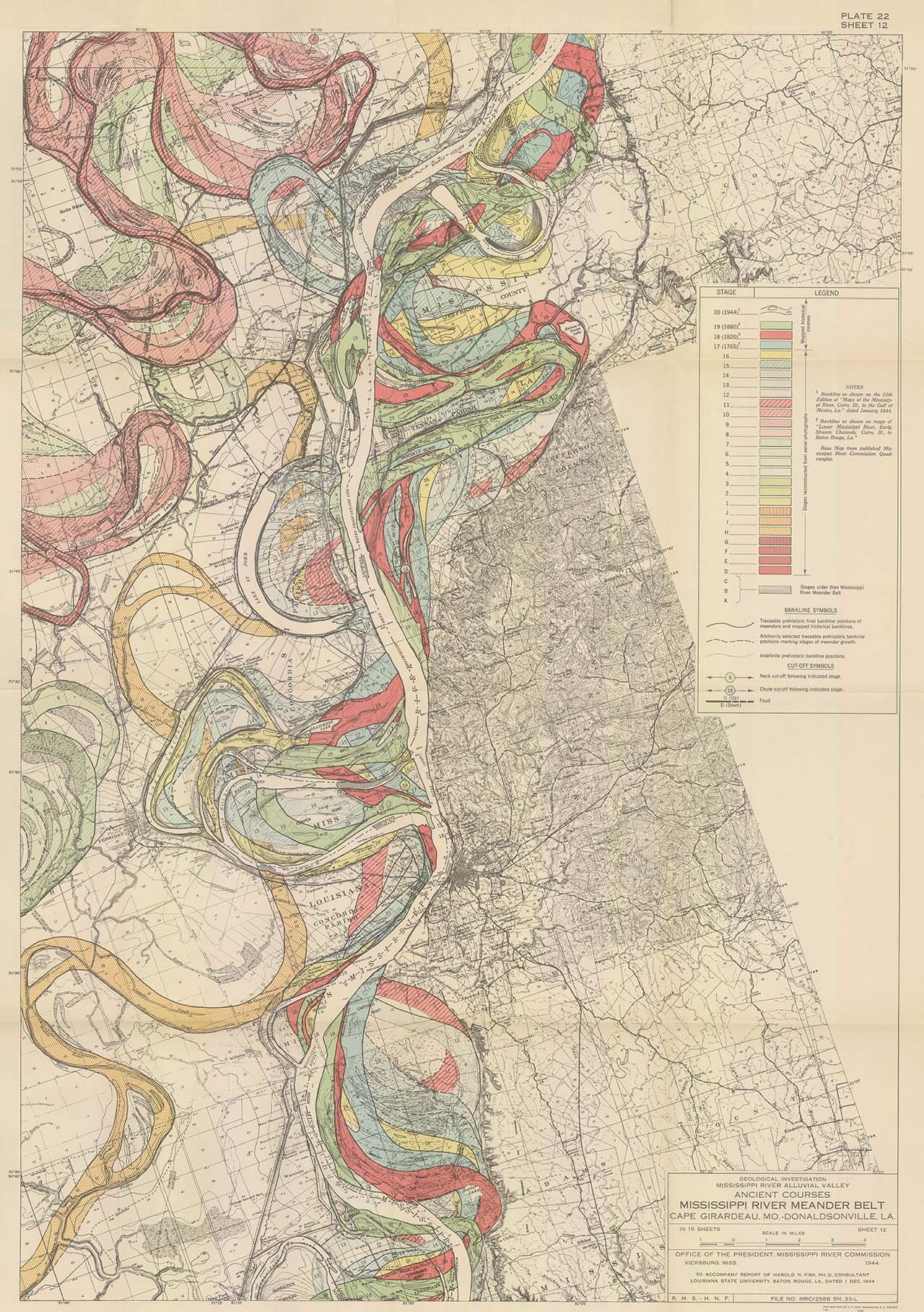
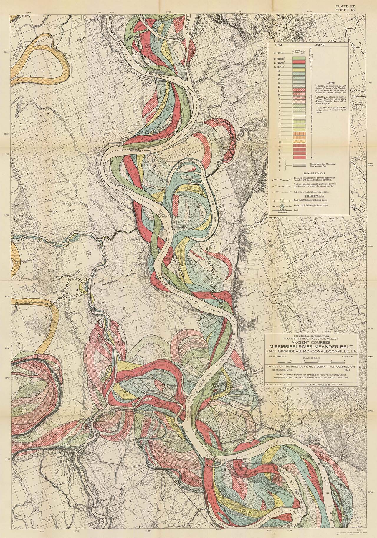
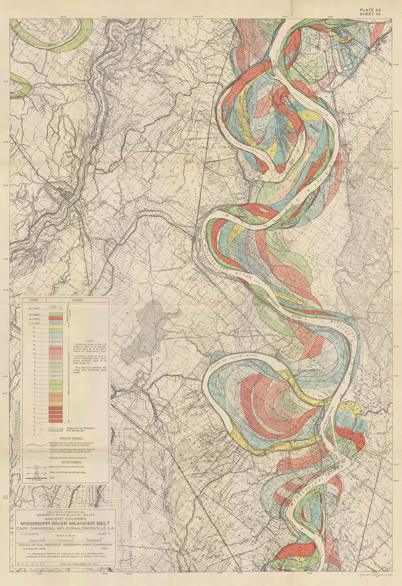
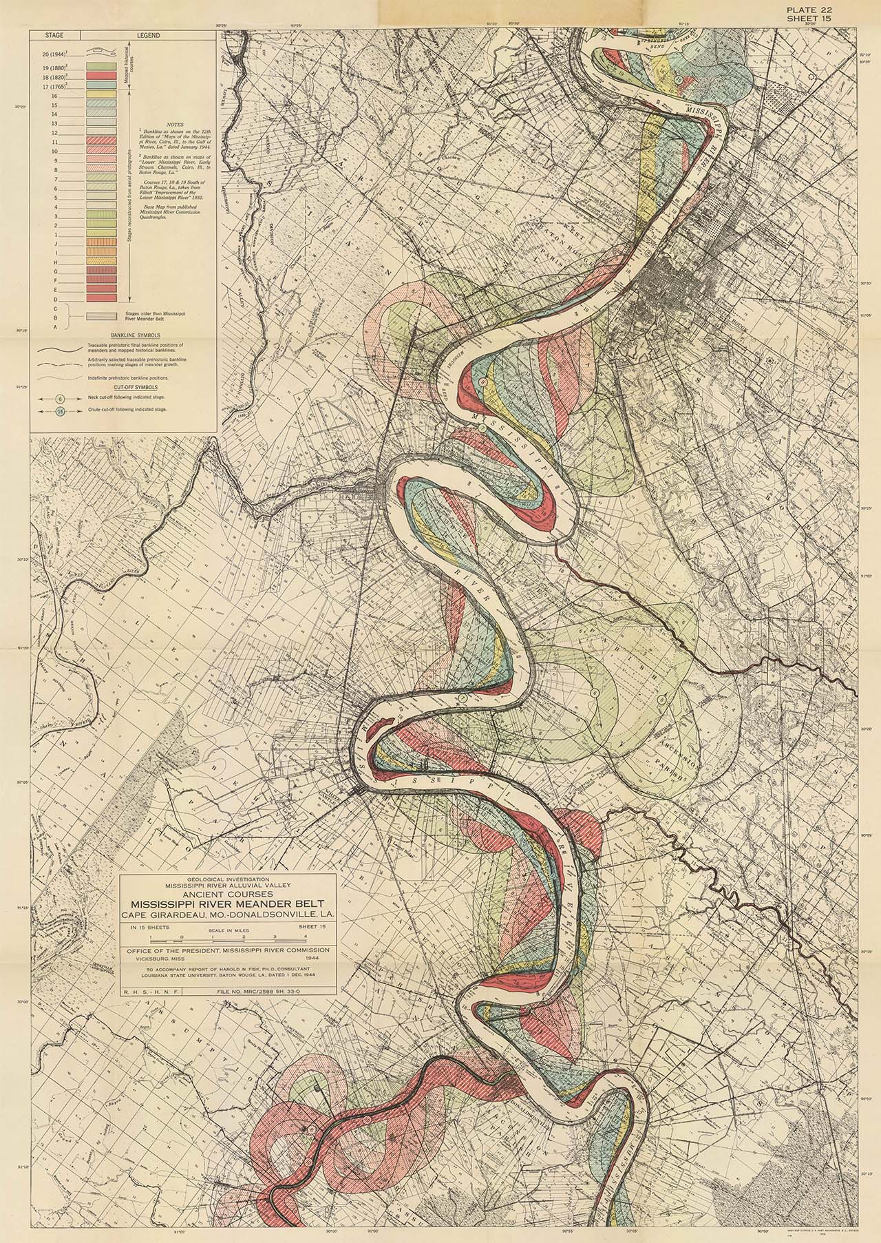
Harold Fisk 1944
Harold Fisk’s Meander Maps of the Mississippi from 1944.
Some time ago I ran a piece on another blog about these beautiful meander maps. I still get referrals so as a courtesy they’re up again. Many thanks for those who reposted and linked back to me all those years ago. You’ve got to love the interwebs for gems like these.
Illustrated here is Plate 22 Sheets 1-15 and look best in the lightbox rather than the grid (just click one of the images and you will launch the lightbox).
Better still, I believe you can still download the ‘Oversized_Plates’ in high resolution .pdfs (they are outstanding) from US Army Corps of Engineers.
There are also some earlier and perhaps less well known images. The Lower Mississippi Stream Channel maps (published in 1938) from Cairo, ILL to Baton Rouge, LA.
These earlier maps are compiled from the Ross Survey of 1765, The Land Office Survey of 1820-30 and Mississippi River Commission Surveys of 1881-93 and 1930-32.
Look for the ‘Mississippi River Early Stream Channels’ and the ‘Oversized Plates’ from the following link…
Get some.
** Update ** If you love maps as I do then there is also this fantastic resource of over 80,000 historical maps here https://www.davidrumsey.com
Please enjoy.
Paul